ORIGINAL RESEARCH
Published on 27 May 2024
Phenospectral similarity as an index of ecological integrity
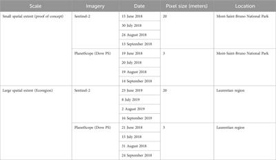
- 1,202 views
1,781
Total downloads
13k
Total views and downloads
You will be redirected to our submission process.
ORIGINAL RESEARCH
Published on 27 May 2024

ORIGINAL RESEARCH
Published on 05 Apr 2024
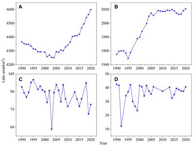
ORIGINAL RESEARCH
Published on 29 Feb 2024
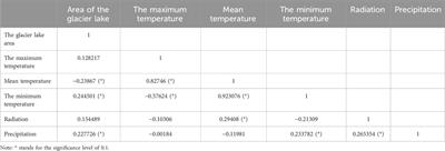
ORIGINAL RESEARCH
Published on 26 Feb 2024
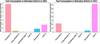
ORIGINAL RESEARCH
Published on 10 Nov 2023
ORIGINAL RESEARCH
Published on 12 Oct 2023

ORIGINAL RESEARCH
Published on 31 Aug 2023

Frontiers in Applied Mathematics and Statistics
Environmental Informatics and Remote SensingOffline
Frontiers in Earth Science
Environmental Informatics and Remote SensingOffline
Frontiers in Ecology and Evolution
Environmental Informatics and Remote SensingOffline
Frontiers in ICT
Environmental Informatics and Remote SensingOffline
Frontiers in Marine Science
Environmental Informatics and Remote SensingOffline