Featured news
02 Aug 2022
Yoda-like tarsiers push virtuoso singing to their physiological limits
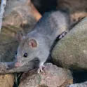
By Mischa Dijkstra, Frontiers science writer Pair of Gursky’s spectral tarsiers, Tarsius spectrumgurskyae. Image credit: Arie de Gier / Shutterstock.com Researchers show that the notes within duets between female and male Gursky’s spectral tarsiers on Sulawesi are taxing for the singers, presumably due to physiological constraints. An individual’s ‘virtuosity’ in singing these demanding notes could thus signal fitness to conspecifics, similarly to the costly tail of peacocks. Opera arias are typically rich in coloratura, for example fast, high notes that stretch over a wide frequency range. Coloratura aren’t just beautiful to listen to: they are also designed to allow the best singers to show off their virtuosity. Now, researchers from Sam Ratulangi University in Indonesia and Cornell University in the US show that pairs of Gursky’s spectral tarsier sing duets that have evolved to similarly show off virtuosity – at least, for those individuals that manage to pull off their species’ version of coloratura: rapidly repeated broadband notes emitted in coordination to form a duet between adult males and females. The results are published today in Frontiers in Ecology and Evolution. The researchers show that not all tarsiers can sing these duets equally well. Some Gursky’s spectral tarsiers achieve a […]